Lambs Head (Kahlpahlim Rock)
-
Address
Davies Creek Road
Lamb Range, Queensland 4870, Australia
Lambs Head (Kahlpahlim Rock)
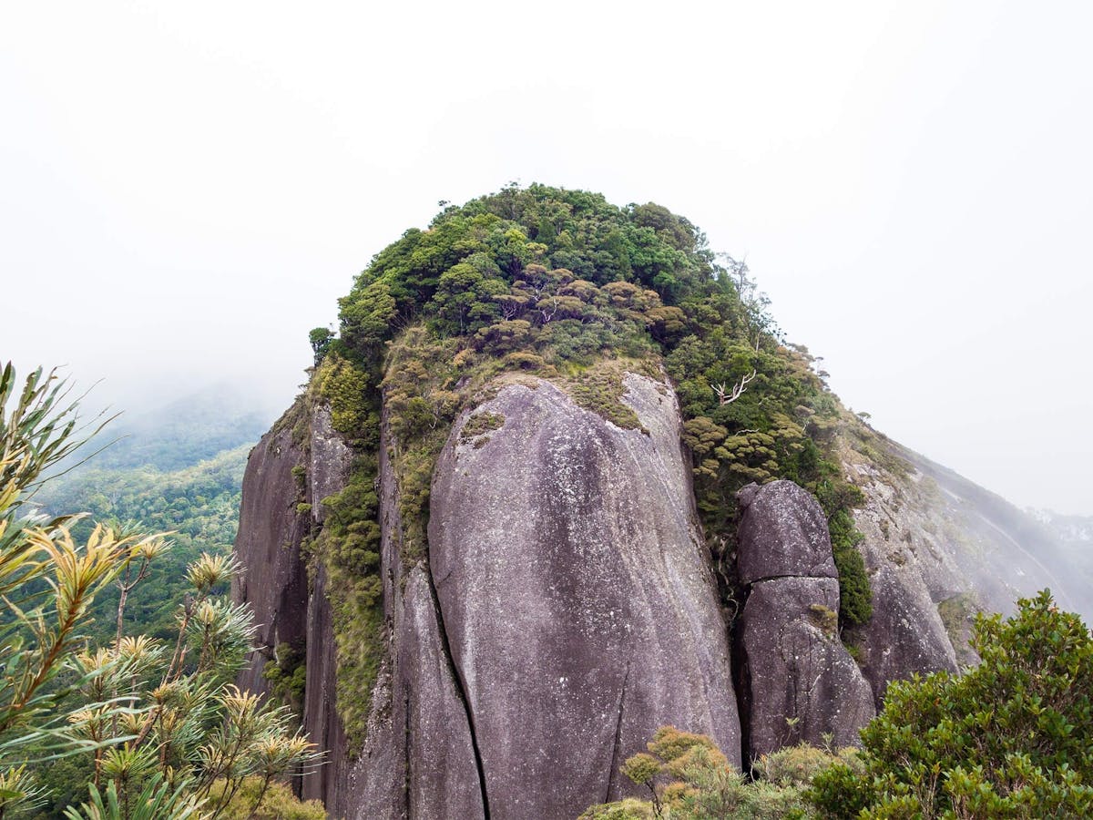
Lambs Head isn’t for the faint-hearted, but not impossible with a good set of hiking boots or trail runners to tackle the steepest of climbs! At approximately 1300 metres above sea level, Lambs Head, otherwise known as Kahlpahlim Rock, is the highest point on the Lamb Range in the Davies Creek National Park. There is a choice of two steep but beautiful trails (Kahlpahlim Rock and Ridge trails) which lead to the spectacular granite boulders of Kahlpahlim Rock. The trails converge near the top allowing hikers to walk the track as a circuit.
It’s recommended to start the walk early, to take advantage of the cooler morning temperatures and allow time to return as the round journey can take up to several hours. It’s best to avoid the walk when the top of the mountain is covered in cloud or after wet weather. Water is not available along the trails so come prepared with extra water bottles and always inform a friend of your plans.
Location
Facilities
Does not cater for people with access needs.
-
Carpark
Lambs Head (Kahlpahlim Rock)