TNQ Writer
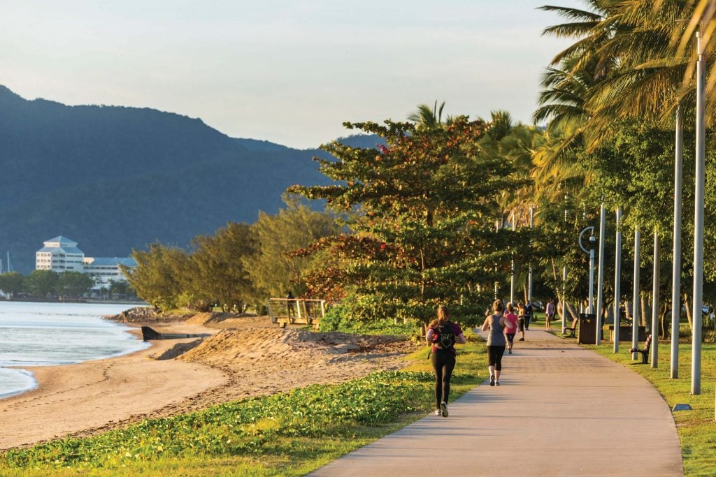
Surrounded by national parks, World Heritage rainforest and the Great Dividing Range, find countless bush walks or hikes within a short distance of Cairns.
Have you ever wondered where the saying “nature is calling” comes from? I hadn’t really thought about it until I heard a wail through the rainforest that I was convinced was a person calling out – cue goosebumps and a small twinge of fear.
Fast forward a couple of hundred metres and it turns out it was coming from two branches rubbing together creating an eerie human-like sound. While I doubt that’s the origin of the term, it cemented a new meaning for me; nature really does call for you. Think of the roaring winds or the cry of birds – nature is constantly communicating with anyone who takes a moment to notice.
While it can be haunting, it can also be immensely exciting and peaceful. Disappearing into the forests and surrounds of Cairns uncovers a world lesser-known – ancient landscapes that are best discovered by foot – and these dramatically beautiful hikes are calling to be explored.
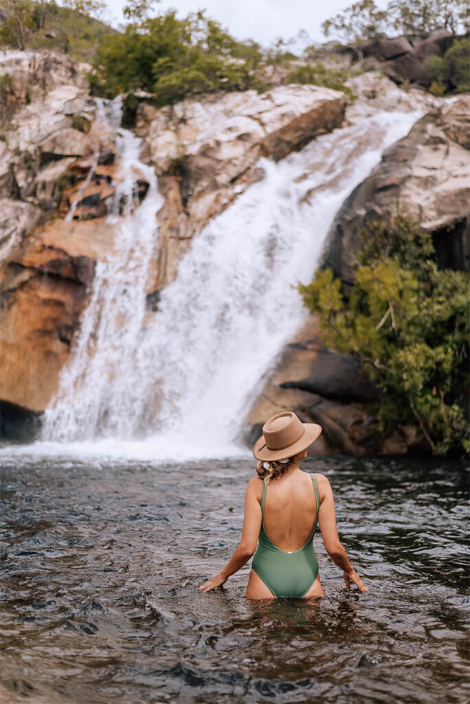
With its diverse wilderness and abundant national parks, Tropical North Queensland is home to many beautiful hikes, waterfalls and swimming holes. It’s important to always follow the advice from Queensland Parks and never venture into out of bounds zones, flooded waters or dangerous areas to prevent serious injury or death.
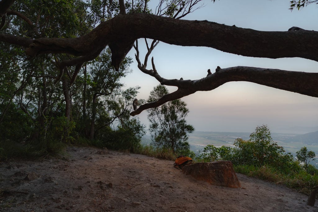
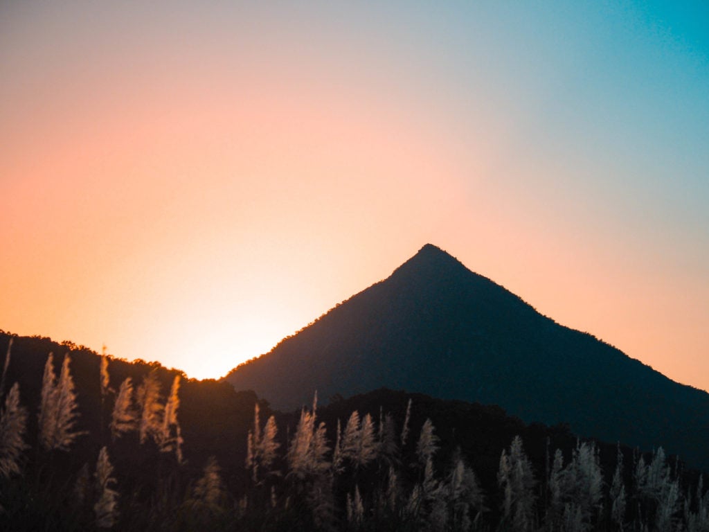
Mt Bartle Frere: The Highest Mountain
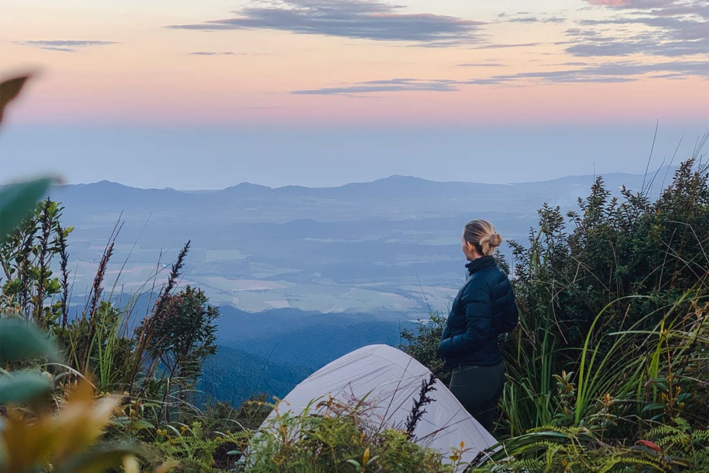
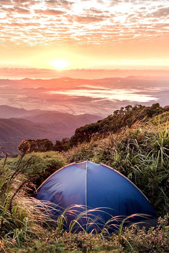
Bartle Frere Sunset – Eastern Approach
While it’s heights might not stand up to the famous great peaks of the world, that doesn’t mean it’s not as impressive. As Queensland’s highest peak, standing at 1622m elevation, the walk to Bartle Frere’s summit ventures through thick World Heritage rainforest, across mossy creek crossings and boulder fields culminating with expansive views to the coast and over the Atherton Tablelands.
There are two trailheads that hikers can choose to leave from, Eastern or Western, both including a number of routes or stops. These challenging walks should only be attempted by experienced hikers and it’s encouraged for walkers to break the journey over two days and camp the night. Touted as one of the best sunrise places of the region, you’ll be able to wake fresh and simply walk straight out of your tent for a sunrise you’ll never forget.
Temperatures at the peak are approximately 10º cooler than the coast so if you’re opting to camp, make sure you’re prepared for cooler weather. #TropicalNorthFreezeland
Top Tip: Like many peaks, the summit of Bartle Frere is only visible 5-10% of the year. If you’re after views, plan your hike for when the forecast is clear.
Where: Eastern approach trailhead leaves from Josephine Falls. Western approach leaves from Topaz, Atherton Tablelands.
Highest elevation: 1,622m
Distance: 15kms return (both Eastern and Western)
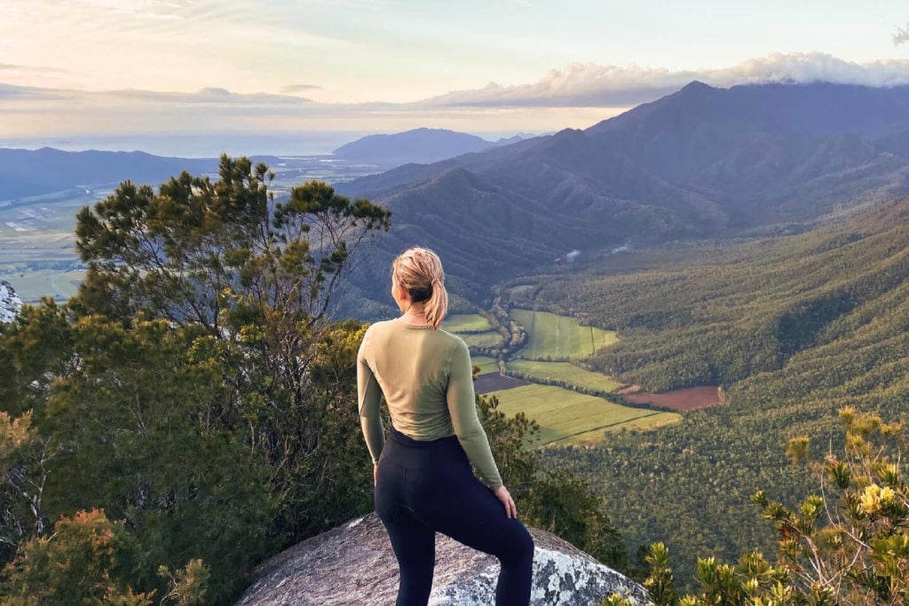
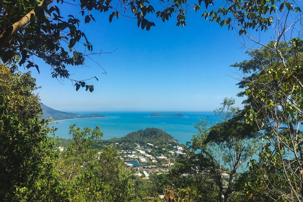
Lambs Head (Kahlpahlim Rock): Diverse Landscapes
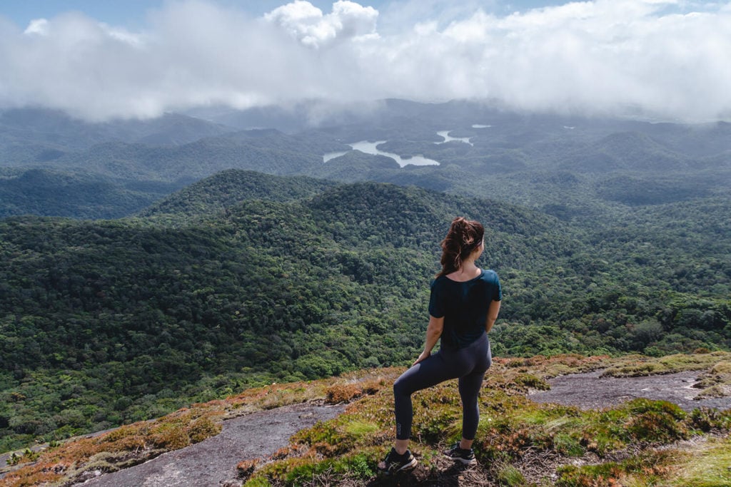
View over Lake Morris and towards Cairns
Have you ever disappeared to a place where you feel like you’re the only ones for miles and miles? Follow an old logging trail on a hike that evokes a feeling of timelessness and tranquillity to Lambs Head (Kahlpahlim Rock). On a clear day, you’ll enjoy views over Lake Morris, all the way to the coastline of Cairns, and back over the Atherton Tablelands.
There are two trailheads that take you to the top – the Ridge Trail and Kahlpahlim Rock Trail. The Kahlpahlim Rock Trail is more shaded, traversing through rainforest and crystal clear creek crossings, while the Ridge Trail travels through open forest featuring tall rose gums and casuarina trees, both converging around a kilometre before the top.
Top tip: Cool off at Davies Creek on your return. There are several places you can choose to swim, including at the pool above Davies Creek Falls.
Where: Both trails depart from Davies Creek Road, Atherton Tablelands.
Highest elevation: 1,309m (795m elevation gain)
Distance: Ridge Trail – 9.2km return, Kahlpahlim Rock Trail – 10.8km return
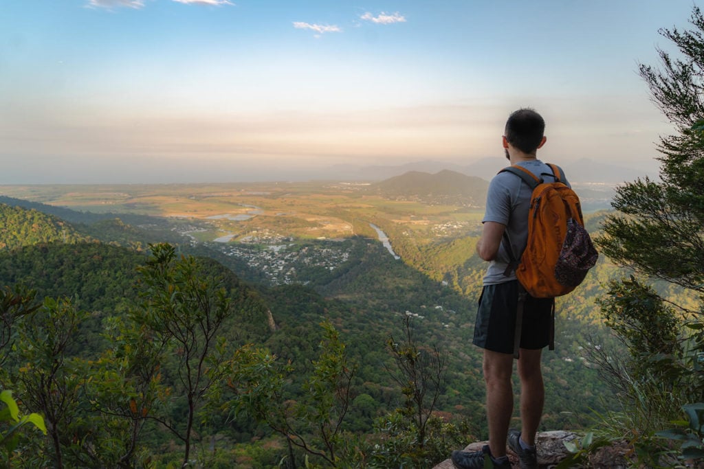
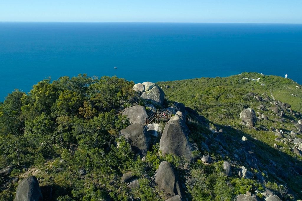
Glacier Rock/The Douglas Track: City & Ocean Views
View from Red Bluff on the way up
View from Red Bluff on the way up
View from the top of Glacier Rock
View from the top of Glacier Rock
There's a large clearing at the top of the trail, great for a snack break and recovery before heading back down
There's a large clearing at the top of the trail, great for a snack break and recovery before heading back down
A favourite among locals for its ease of access and stunning views, Glacier Rock via The Douglas Track is a challenging but rewarding hike located a short 25 minutes drive from Cairns. The trailhead starts at the popular Stoney Creek swimming hole which is a welcome place to cool off on your return. From here, it climbs through the rainforest, crosses over the famous Kuranda Scenic Railway line, and meanders through the open grassy paths.
You’ll have no lack of views on your way with vantage points of the Barron River and Red Bluff offering ocean views on your way up. The real MVP is the view from the top which peers over the canopy and all the way to Cairns. There’s an open shaded area perfect for a snack to refuel before making your way back down.
Top tip: The Douglas Track intersects with McDonald’s Track 1.2kms before the end. From here, you can take the McDonalds track to Speewah near Kuranda on the Atherton Tablelands (an additional 5.2kms).
Where: Trailhead departs from Stoney Creek in Kamerunga, 25mins from Cairns.
Highest elevation: 488m (440m elevation gain)
Distance: 9km return
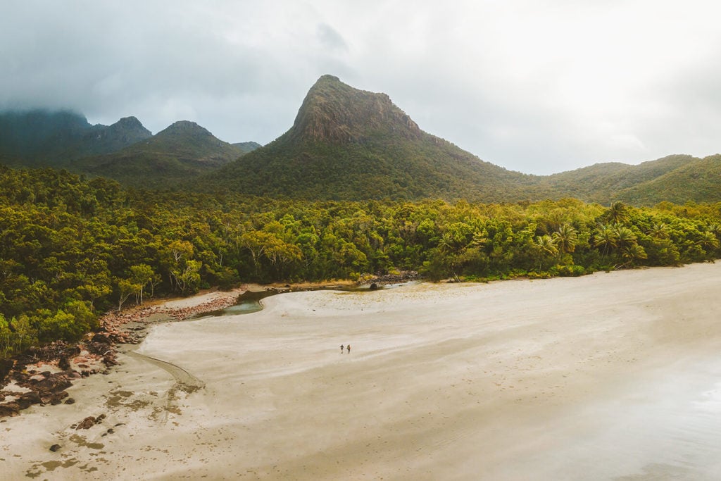
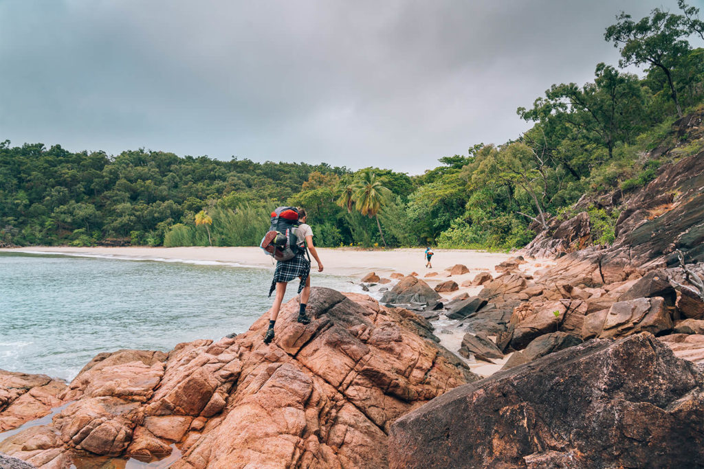
Thorsborne Trail: Multi-Day Hike

One of the Thorsborne Trail highlights, Zoe Falls
One of the Thorsborne Trail highlights, Zoe Falls
Rugged Hinchinbrook Island
Rugged Hinchinbrook Island
Diverse environments of the trail
Diverse environments of the trail
Get ready for the untamed wilderness of Australia’s largest island national park, Hinchinbrook Island. This 32km three night, four day hike encompasses diverse terrain from mangroves and eucalypt woodlands to rainforest and refreshing swimming holes beneath cascading waterfalls, rugged ranges and isolated beaches.
You’ll need to plan your trip in advance as the number of hikers is limited to a maximum of 40 people on the trail at any one time (largest group size is six) and camping permits must be obtained through Queensland Parks.
Top tip: This walk is fully self-sufficient. You’ll need to ensure you have enough food and water for your journey, and you’ve researched whether any of the creeks will be flowing enough to top up your water supply.
Where: Off the coast of Cardwell, around two hours south of Cairns.
Highest elevation: 260m
Distance: 32kms (one way). Boat transfers need to be arranged prior for pick up and drop off.
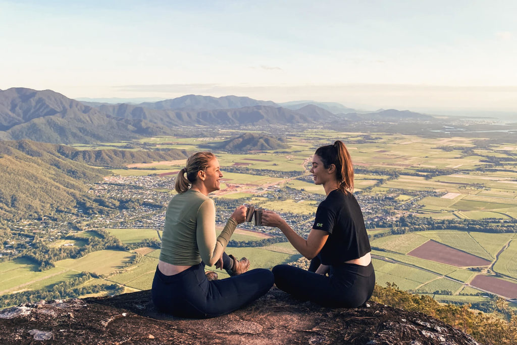
Walshs Pyramid: Rewarding Views
Bring a thermos to enjoy a coffee at the summit
Bring a thermos to enjoy a coffee at the summit
View from Walshs Pyramid summit looking south
View from Walshs Pyramid summit looking south
Walshs Pyramid's unique shape
Walshs Pyramid's unique shape
You don’t have to head to Egypt to find pyramids, you’ll find a natural one just 25 minutes south of Cairns. This 6km return trail steeply climbs to the summit standing at 922m rewarding you with incredible views over the patchwork of sugarcane farmlands below as well as down the thick, lush rainforests of the Bellenden Ker range to and towards the Goldsborough Valley.
Allow 4-5 hours to complete this walk. It’s fairly short distance means the elevation gain is quite quick and challenging. Stop off in the town of Gordonvale after for some sustenance at the local bakery or a refreshing drink one at one of four local pubs in the small town centre.
Fun fact: Each year in August is the legendary Great Pyramid Race, a 12.2km race from the township of Gordonvale and back. The current record stands at 1:15:34 set in 2007 by Neil Labinsky, while the women’s title has been held for over 20 years by local runner Anita Appleby at 1:32:06.
Where: Find the trailhead just off the Bruce Highway opposite the Aloomba turnoff.
Highest elevation: 922m
Distance: 6 km return
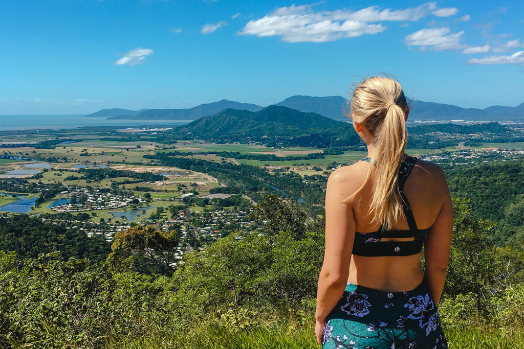
Mt Whitfield Walking Trails: Convenient Location
Red Arrow Circuit, Mt Whitfield Walking Trails
Only five minutes drive from Cairns CBD, you’ll enter Collins Avenue, a street shrouded by leafy vines and branches bursting with greenery, creating a rainforest oasis within the inner city suburbs. From here leaves a network of trails traversing Mt Whitfield, also known as the “Arrow” trails, of which you’ll find four: Red Arrow, Blue Arrow, Yellow Arrow (are you sensing a pattern here?) and Green Arrow.
These tracks vary in length and difficulty but the one common factor is that you’re guaranteed a great workout and million-dollar views. There are also trailheads at nearby Aeroglen for the Yellow Arrow, and the suburb Whitfield for the Green Arrow.
Top tip: Use mozzie repellent before embarking on these trails to protect from mosquitoes and midges which are prominent during some periods of the year.
Where: Tracks depart from inner suburbs Edge Hill, Whitfield and Aeroglen.
Highest elevation: 364m (Green Arrow)
Distance: Tracks vary between 1.5–6kms
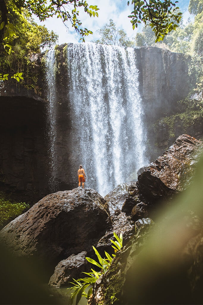
Behana Gorge: Swimming & Waterfalls
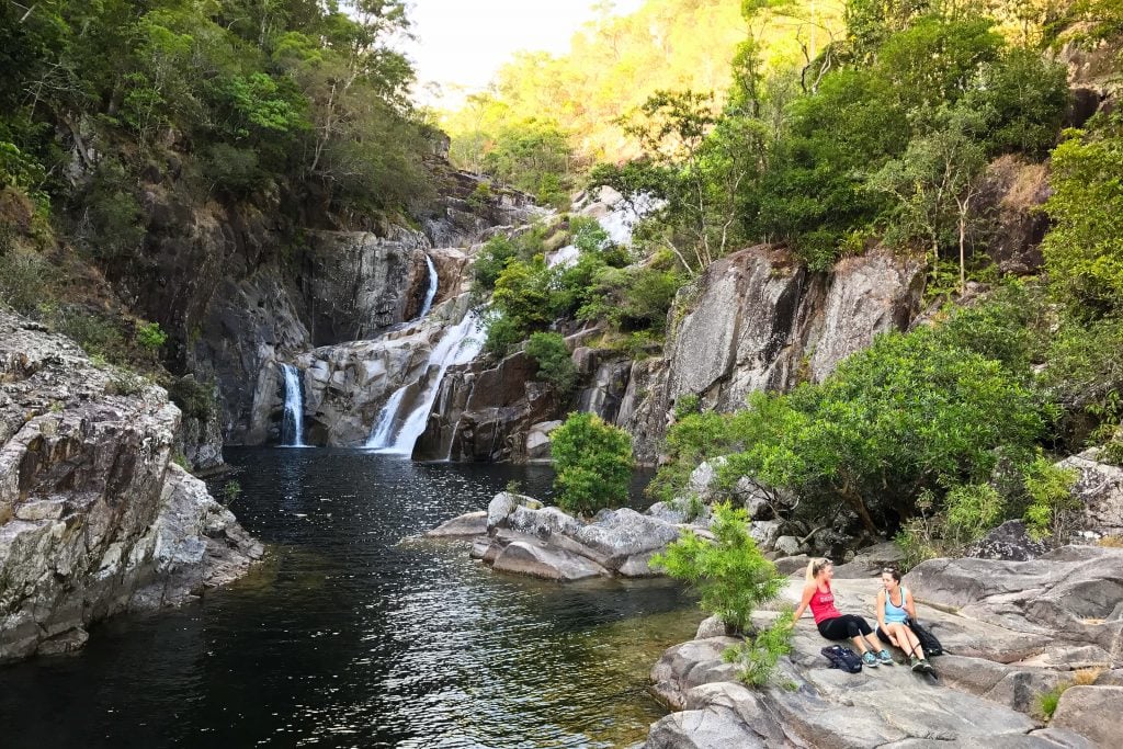
Clamshell Falls at Behana Gorge
No matter the time of the year it is, when you jump into the crystal-clear waters of Behana Gorge, your skin will erupt in goosebumps. Flowing off Mt Bellenden Ker, Queensland’s second-highest peak, the water of Behana Gorge maintains a cool temperature year-round, and is some of the freshest, clearest waters you’ll have the pleasure of swimming in.
The chilly waters are a welcomed reprieve from the undulating trail which finishes at the magnificent Clamshell Falls. There’s plenty of space to spread out, have a picnic or simply float until it’s time to head back home.
Top tip: Test your courage with a Cairns Canyoning, who take you abseiling, cliff jumping, sliding and swimming through some of the lesser-known spots of the gorge.
Where: Just south of Gordonvale, 35mins from Cairns.
Elevation gain: 194m
Distance: 6.6kms (return)
Fitzroy Island Summit: Island Views
Fitzroy Island Summit
Tear yourself away from the peaceful clink of the sea meeting coral beaches for a short while to take advantage of the 360 degree views of rainforest tumbling down to Great Barrier Reef and the isolated mainland coast from the Fitzroy Island Summit.
You have two options to get here; The Summit Track or The Lighthouse Track. The latter can be paired with a trip to the historic lighthouse and you can do a round trip between the two.
Top tip: Pick up a copy of the self-guided walking trail booklet to uncover some of the history of the island. This is free to hotel guests, or cost $4.40 for day visitors.
Where: Fitzroy Island, 45min ferry from Cairns
Highest Elevation: 269m
Distance: Summit – 4km return, Summit + Lighthouse – 4.6km return
Earl Hill: Beach Views
View from summit of Earl Hill
Compared to the other hikes on this list, this one might feel like a walk in the park (pun intended), though rest assured, it still tests the legs and the glutes. Located in Cairns’ Northern Beaches suburb of Trinity Park, this 1km ascent to the summit offers a constant cooling sea breeze with beach views thrown in for good measure.
The track has recently undergone a refurb, so now you can take an additional detour all the way down to Half Moon Bay, or start your walk from the beach. Dogs on leads are permitted on this track.
Top Tip: You can also follow a track that connects to the southern end of Trinity Beach. From here you can continue to walk along the foreshore and stop for breakfast, lunch or a cool drink at a variety of cafes and restaurants.
Where: Trinity Park, Cairns Northern Beaches
Elevation gain: 197m
Distance: Summit Track – 2km return
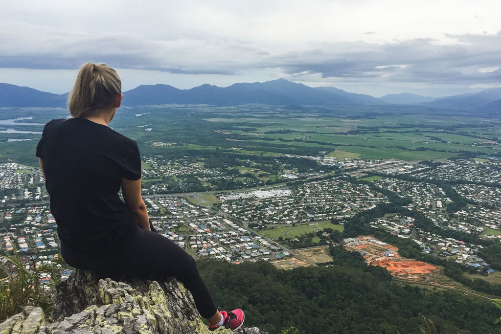
White Rock Peak: Southern Cairns Views
Views from the White Rock Lookout
Rewarding views and a moderately challenging walk can be expected on the White Rock Peak trail. Your hike begins at approximately 500m in elevation so there’s not too much climbing required in comparison to the views you can expect. However, the trail is still fairly steep in some parts, particularly the last 150m which drops down to the White Rock lookout so a reasonable level of fitness is required. Allow approximately two hours to complete the return hike.
Keep an eye out for the steel gates and green hiking marker which indicate the trailhead – if you’re not looking out for them they can be easy to miss. The road is also a popular training route for cyclists, and cassowaries are known to frequent the road, so please take care when driving.
Lake Morris Road opens to the public daily between 8am and 8pm so be aware you will not be able to access the trail outside of this time.
Where: Trailhead is approximately 9.5kms/ 20mins drive along Lake Morris Road.
Highest elevation: 612m (272m elevation gain)
Distance: 4.8km (return)
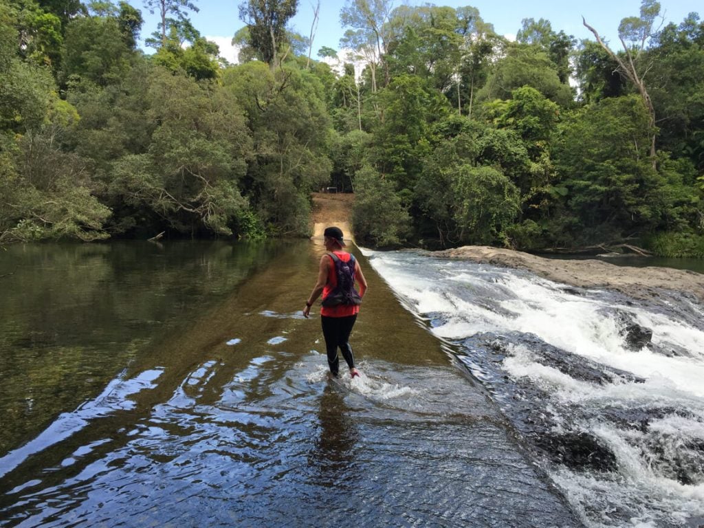
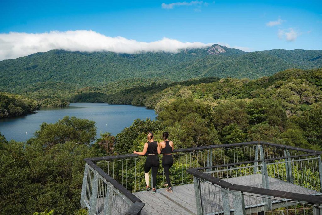
Crystal Cascades to Lake Morris (Copperlode Dam)
Lookout with view towards the Lamb Range over Lake Morris
Pack a picnic for this hike as you’re going to want to relish the views over Lake Morris (Copperlode Dam) with its mountainous backdrop for a while (hello Lambs Head). Your hike begins at the popular swimming hole Crystal Cascades and climbs through Dinden National Park to the beautiful Lake Morris. Here you’ll find picnic tables (both uncovered and covered), grassy lawns, tropical gardens and informative signage about the region, Traditional Custodians and the lake which is the primary water supply for the Cairns region.
To protect the water quality, access to the lake is only available through Copperlode Fish & Kayak, who hold the only permit for kayaking, paddle boarding and fishing on the lake. If you would like a swim, cool off at Crystal Cascades upon your return.
Lake Morris (Copperlode Dam) opens to the public daily between 8am and 6pm so be aware you will not be able to access the picnic area outside of this time.
Where: Out-and-back hike departs from Crystal Cascades, shortly after the steel gates on the left.
Elevation gain: 490m
Distance: 6.6km (return)
Goldfield Trail: Thru-Hike With Camping
The causeway is located approximately halfway along the trail and offers camping and a toilet
The causeway is located approximately halfway along the trail and offers camping and a toilet
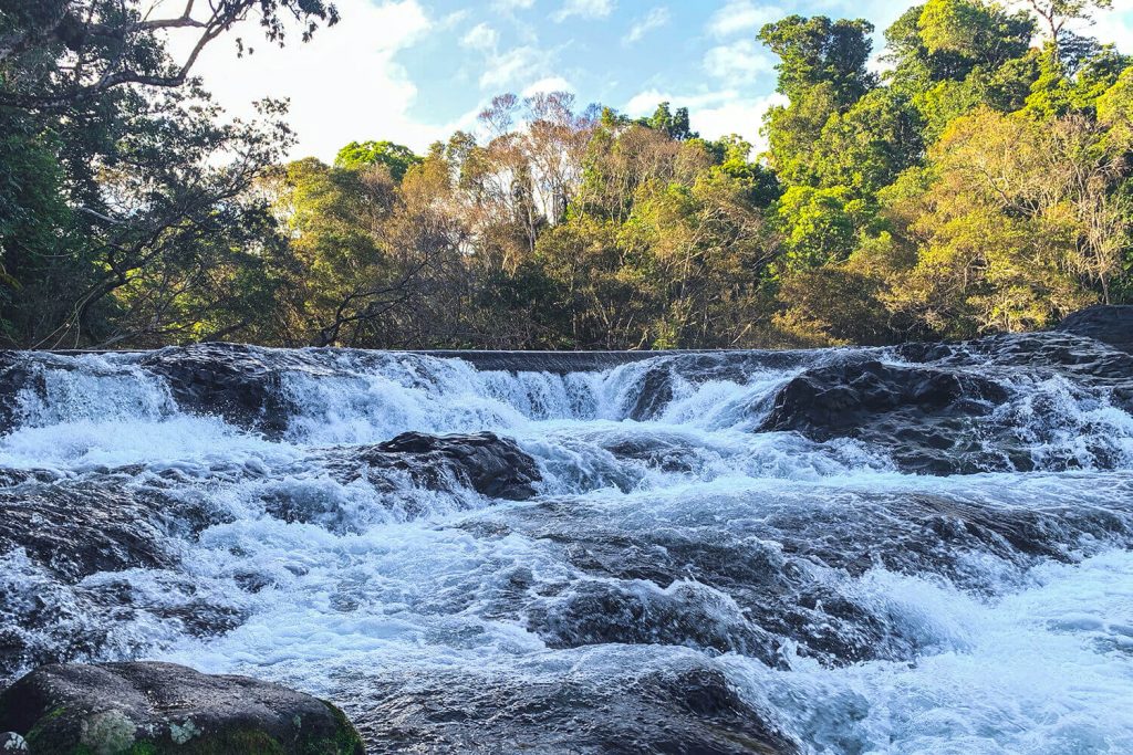
Waterfall rapids below the causeway
Waterfall rapids below the causeway
Enjoy scenic views and creek crossings along the way
Enjoy scenic views and creek crossings along the way
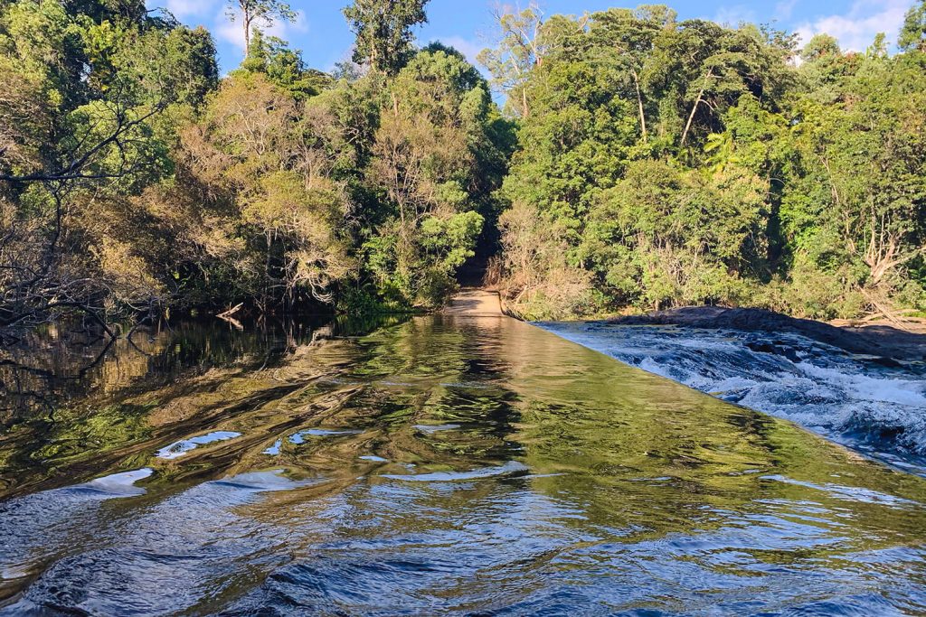
This 19km trail follows a historic trail in Wooroonooran National Park linking Goldsborough to Babinda. Scenic lookouts, picturesque creek crossings and interesting flora and fauna make this a walk you’re sure to enjoy.
There are a few ways you can choose to do the Goldfield Trail; you can start at either Babinda or Goldsborough Valley, undertake the whole trail as a day hike, walk to the causeway and back the same way, or camp overnight at the causeway (approximately halfway on the Goldsborough side). Camping must be pre-booked, all camping gear will need to be carried in, and Queensland Parks fees apply. There is a toilet located by the campground.
If you are planning to undertake the whole journey, you will need to arrange a pick up or leave a car at the opposite end of the trail. Both trailheads offer parking and camping nearby.
Where: Between Goldsborough Valley day use area and Babinda Boulders
Elevation gain: Up to 524m, depending on how you choose to undertake
Distance: 19kms (one way), allow 7-9 hours
Hike Safely by Following These Tips
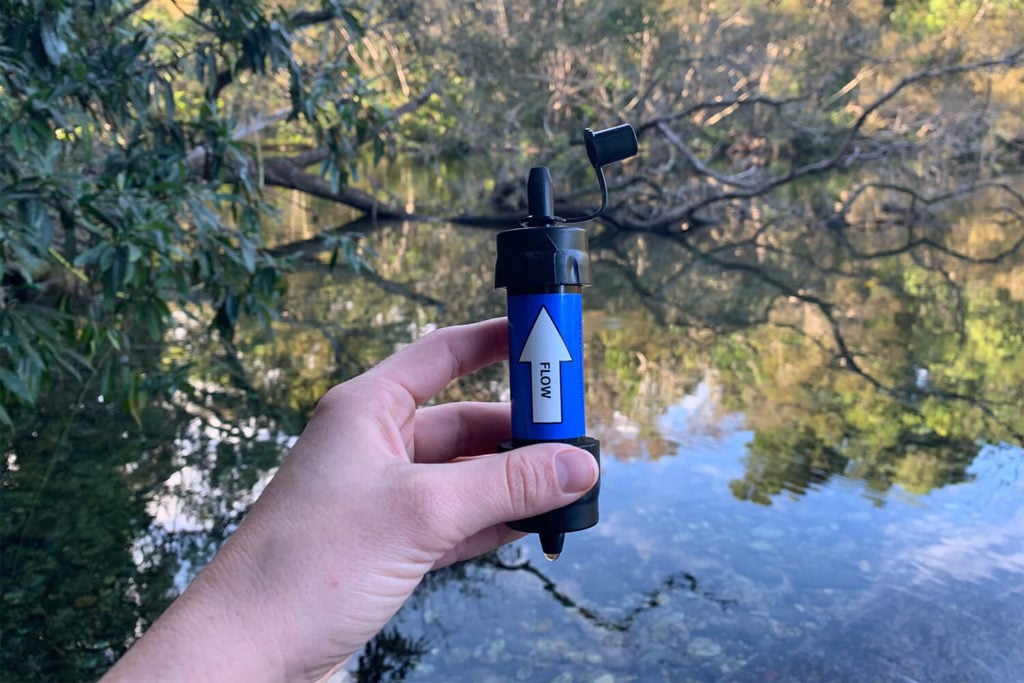
Water filters are a great addition to your safety pack. Many filter out >99.99% of bacteria.
- Tell someone where you are going and when you expect to be back.
- Ensure you pack enough water. If you’re not from the tropics, you will need more water than you would normally take on a walk.
- Avoid hiking in the middle of the day.
- Consider packing a personal beacon locator (PLB) or satellite phone.
- Pack a first aid kit. We Are Explorers have a great guide on what to pack. We also recommend a water filter like Sawyer.
- Check trail conditions and research the trail well before you embark.
- Have a plan in place in case you or one of your party are injured.
- Ensure you are undertaking a trail that is within your fitness capabilities.
- Stay on the marked trails.
- Keep your distance from wildlife.
- Only swim where you are sure is safe.
- Pack some snacks to help prevent fatigue.
-
![]() Sports20 - 21 Apr 2024
Sports20 - 21 Apr 2024Queensland Highland Dancing Championships
View event -
![Major performances at the cairns indigenous art fair]() Arts & Culture1 - 31 May 2024
Arts & Culture1 - 31 May 2024Local Events, Arts and Culture – May
View event -
![]() Sports3 - 6 May 2024
Sports3 - 6 May 2024NQ Games
View event -
![]() Sports10 - 12 May 2024
Sports10 - 12 May 2024Cairns Expo
The region’s largest event of its kind, showcasing the latest products and services for our homes, lifestyles and outdoor adventure.
View event -
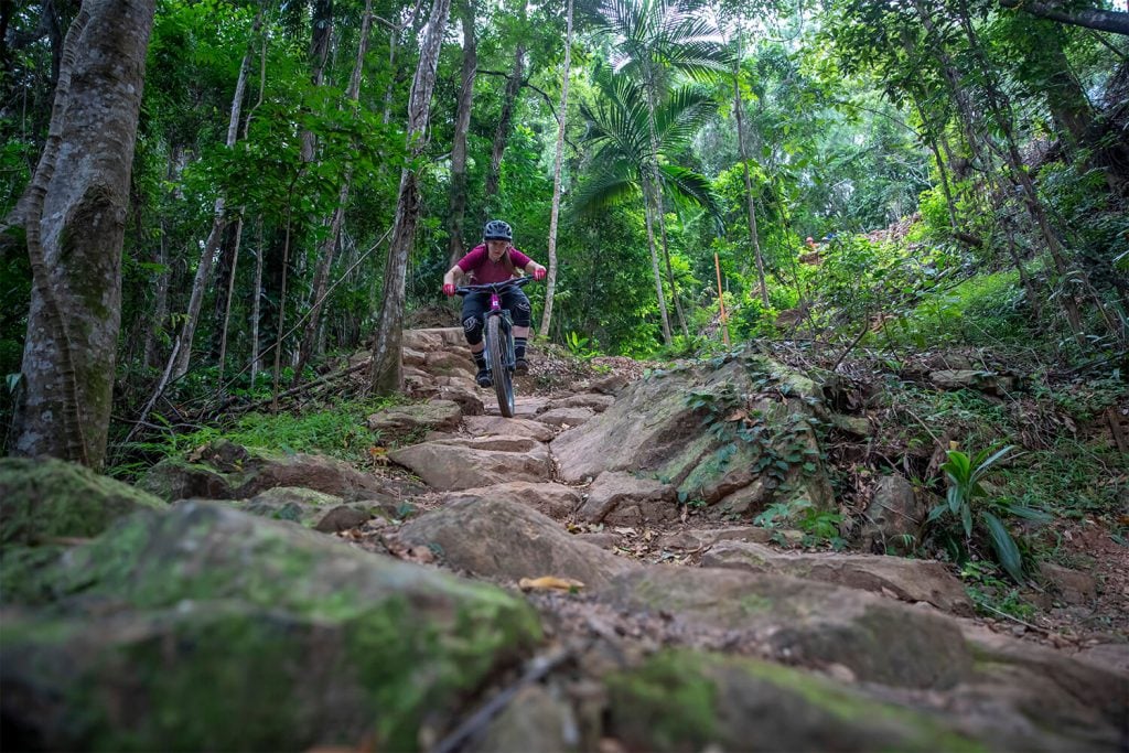
![Smithfield Roll Down]() Sports15 - 19 May 2024
Sports15 - 19 May 2024UCI Mountain Bike Masters World Championships
Smithfield is rainforest riding at its best with steep shoots to long sections covered with roots to keep you on your toes and best of all, it all finishes on the beach!
View event